Exploring Mount Taranaki

Nora
| 10-11-2026
 · Travel team
Mount Taranaki rises above the green farmland of New Zealand's North Island, its remarkably symmetrical volcanic cone dominating the western horizon. Standing 2,518 meters tall, it is one of the country's most recognizable mountains, offering everything from peaceful forest walks to demanding alpine adventures.
Known officially as Taranaki Maunga, the mountain also holds deep cultural significance for local Māori. Under a 2025 settlement, it gained legal personhood as part of Te Kāhui Tupua, recognizing the mountain and surrounding peaks as a living, indivisible whole. Visiting respectfully means understanding both its cultural importance and its unpredictable conditions.

What you're actually looking at
Taranaki Maunga is an active stratovolcano formed through successive eruptions over approximately 130,000 years. Its relatively young volcanic cone gives it the distinctive, almost symmetrical shape visible from New Plymouth and the surrounding countryside.
The mountain stands within Te Papa-Kura-o-Taranaki, formerly Egmont National Park, where dense native forest surrounds the lower slopes.
From above, the protected forest forms a striking circular boundary against the farmland beyond, reflecting the historical limits of the reserve.
The mountain's cultural identity is equally important. For Taranaki Māori, the maunga is an ancestor with profound spiritual connections to the land and its people.
Visitors should respect cultural guidance, including refraining from standing directly at the summit's highest point.
The summit route, honestly
The main summer summit route begins at North Egmont, also known as the Taranaki Maunga Visitor Center area.
Reaching the summit and returning typically takes around 8 to 10 hours, sometimes longer depending on fitness, weather, and track conditions.
The route climbs steeply through exposed terrain, loose volcanic scree, and rocky sections including the Lizard before reaching the crater area.
This is a demanding alpine climb, not an ordinary hiking trail.
Rapid weather changes, poor visibility, snow, and ice have contributed to serious accidents and fatalities.
Even in summer, alpine equipment may be necessary.
Only attempt the summit with suitable experience, preparation, and conditions. An experienced guide is worth considering if you lack the necessary mountain skills.
Mt Taranaki
Lower tracks that still deliver
You do not need to reach the summit to experience Taranaki's beauty.
The Pouakai Crossing is a challenging full-day walk of approximately 19 kilometres, offering forest scenery, alpine wetlands, and remarkable mountain views.
The Mangorei Track provides access to Pouakai Hut, generally taking around 2 to 3 hours uphill.
The hut has 16 bunks, and overnight stays require advance booking.
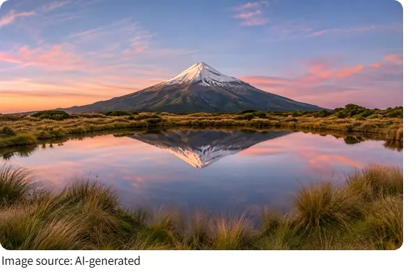
Nearby Pouakai Tarns are famous for reflecting the mountain on calm, clear days. Stay on the boardwalks to protect the fragile wetland.
On the eastern side, Dawson Falls offers a gentler outing. Short forest trails lead to viewpoints overlooking the approximately 18-metre waterfall.
These lower routes provide memorable scenery without the risks of a summit attempt.
Timing and the weather problem
Taranaki Maunga is known for rapidly changing mountain weather.
A clear morning can turn cloudy, windy, or wet within a short time, particularly on exposed upper slopes.
Summer, generally December through March, offers the most favourable opportunities for climbing, although snow and ice can remain and conditions are never guaranteed.
Winter ascents require advanced alpine skills, including confident use of crampons and an ice axe.
Check a detailed mountain forecast rather than relying only on conditions in New Plymouth.
Strong winds, low cloud, and freezing temperatures can make even familiar routes hazardous.
Set a turnaround time before starting and be prepared to abandon your plans if visibility or weather deteriorates.
Getting there and practical costs
New Plymouth makes a convenient base for exploring the mountain, with the North Egmont trailhead approximately 30 to 40 minutes away by car.
Stratford is another practical option, particularly for visitors exploring the eastern approaches and Dawson Falls.
Public transport to the main trailheads is limited, so a rental car or arranged shuttle is usually necessary.
Shuttle prices vary by route and operator, with some transfers costing around NZ$50–70 (approximately US$30–42) per person.
General access to the protected area is free, although hut accommodation and certain services carry charges.
Pouakai Hut has separate booking fees, which should be confirmed before traveling.
Bring food, water, and fuel supplies from town, as facilities near the mountain are limited.
Small things that make a difference
Preparation can make a major difference when exploring Taranaki Maunga.
Tell a trusted person your intended route and expected return time, and carry a reliable means of emergency communication.
Mobile coverage is inconsistent in parts of the mountain.
Pack waterproof clothing, warm layers, sturdy footwear, sufficient food, and plenty of drinking water.
Do not rely on finding safe drinking water along the upper summit route.
At higher elevations, temperatures can drop quickly even when the surrounding lowlands feel warm.
For photographers, early mornings often offer clearer views, particularly around the Pouakai Tarns, though reflections depend on calm conditions.
Above all, choose a route that matches your experience and treat reaching the summit as optional rather than essential.
Taranaki Maunga offers far more than a beautiful volcanic silhouette. Its forests, waterfalls, alpine wetlands, and challenging summit routes reveal different sides of one remarkable landscape. Whether you spend a quiet morning at Dawson Falls or prepare for a demanding climb, the experience rewards patience and respect. Check the mountain forecast, understand the cultural significance of the maunga, and choose your route carefully. Sometimes the most memorable view comes not from standing at the top, but from looking up at the mountain from below.